Maintaining Balance at Work, in Life, and on a Bicycle Redux

This is a refresh of an article I wrote for a company newsletter a few years ago.  I figured it needed an update with the events of 2017, because it reminded me how much maintaining a good work/life balance is key to enjoying life.

If you asked anyone that knows me to tell you something about me it’s that I like bicycles. It’s true that I’ve spend a lot of time with bikes: commuting, exploring, racing, road, mountain, fat or otherwise.  What doesn’t always come through is my love for the outdoors in general, and my choice in employers in more recent years has allowed me to maintain a healthy work/life balance that I didn’t recognize that I needed in the past, and I’ve come to appreciate even more as time passes.  

I’ve been working in the construction industry in some way, shape, or form since 1998.  The thing you will notice if you look at building trends over the years is our homes and workplaces have gotten much more comfortable in the last 100 years protecting us from the elements better than ever before, but that doesn’t mean we shouldn’t spend time outside.  Just look at office buildings and how much natural light they let in now versus those built a century ago.  Why would you want to go outside when you have all that natural light streaming in?!

I’m always planning my next adventures, and looking back at past trips to learn from those experiences.  One example of a learning experience was spring of 2016 when I spent most of a week in Colorado with a friend riding our mountain bikes, but that wasn’t by choice.  We had planned on visiting some trails in Arkansas.  However, just like the previous 2 years I’ve gone, Mother Nature rained (or snowed) on our parade.  So when we woke up to raindrops hitting the tents and big storms to our South, instead of Arkansas we pointed the truck West and went to Colorado.  We ended up having a great time, managed to get about 100 miles of singletrack under our tires, and rode places we hadn’t been to previously.  I have clearly learned not to go to Arkansas in March, but you would think I would have figured that out after the first 2 trips.

In June of 2016 the hearts of my wife and I called us back to Isle Royale for the third time and we were able to truly disconnect for a while.  Isle Royale is the kind of place that if you’re lucky you might get a cell signal from Canada.  (Click here for details on that trip) That little strip of land in the middle of the Gitchee Gumee may be our favorite place to visit, it’s a magical place after all.  Our first two trips to the Island brought us to either of the two main ranger stations, and from those points we hiked out for several days in different directions never being more than a day’s hike away from the ferry. It allowed us to learn a lot about the terrain and what to expect on future trips.  This time around we took the ferry from Grand Portage to McCargo Cove, and then spent the next 8 days hiking across the island back to Washington Harbor.  Sure we could have done it faster, but we want to make sure we enjoy ourselves and leave some time to explore and take photos.  And as with many of our trips, plans had to be adjusted part way through due to weather.  We’re people, and we can adapt, so we did.

In the past we’ve also gone to South Dakota (Black Hills/Badlands), Montana (Glacier NP), Colorado (Estes Park/Rocky Mountain NP), Ontario, (Sleeping Giant Provincial Park) and Utah (all 5 National parks; Arches, Capitol Reef, Bryce Canyon, Zion, and Canyonlands), not to mention our countless trips to the North Shore of Lake Superior.  In 2017 our honeymoon finally took us to the East Coast where we spent 9 days in Maine and Boston.

One thing is for sure, in the years since I’ve started attending various mountain bike races and events, I’ve learned a lot about myself, what my limits were, and have really pushed those boundaries a few times.  I remember when 7 miles was a struggle, but in 2014 I pushed myself to ride 7 laps (79 miles) in 13 hours at the Wausau 24.  This year I’m hoping to push myself further than I have in recent years, but I haven’t figured out what that means yet!

I guess what it comes down to is I’ve spent a lot of time over the years either behind a desk or a steering wheel with very little free time, but life doesn’t have to be that way.  For a person like myself who is active outdoors I needed the freedom my career has allowed me to have, and I’m thankful for that opportunity today. Sure, we get busy stretches here and there, but that doesn’t mean we shouldn’t take the time to spend a little time outdoors.  

October Backroad Adventure


Map of our drive

So, back in October we took advantage of heading to my cousins wedding to take a long weekend up north and do some extra exploring in our new-to-us truck.  We often head to the North Shore when we need to get away for a few days, and we hadn’t been for all of 2017 due to wedding planning and the like, so we both scheduled an extra day off of work and went for it.

We started our day waking up before Sunrise by hitting 61 and heading up the shore to the Coho Cafe in Tofte.  It’s one of many great restaurants along the way so we make it a point to visit when we can.  From there we continued to up to Grand Marais to visit Artist Point, and then up to Wayswaugoing Bay Overlook outside of Grand Portage.

DSC07083.jpg
View from Wayswaugoing Bay Overlook.

From there we turned back and went up old US 61 to the location of the old United States/Canada border crossing.  There’s  some dilapidated buildings there, and it looks like someone converted the buildings on the Canadian side to a nice little homestead.  The bridge is long since gone, and the Pigeon River still roars below.

On the way out to the boarder crossing I noticed a few other roads I don’t remember seeing in past travels, so we decided to drive down Partridge Falls Road until we got to the Pigeon River again.  We got out and looked around a bit, but I couldn’t figure out the route to get to the actual falls, so we turned back towards the direction of Mt. Maude.

You can drive most of the way to the top of Mt. Maude on a double track forest road, and a high clearance vehicle is probably recommended, but the maintenance road is gated off so you need to hike the last few hundred vertical feet.  Up top there is a communications tower and an old fire tower you can ascend.  We didn’t quite make it to the top as 2 guys passed us on the stair as I stopped on one of the stair landings to take some pictures and I didn’t feel like sharing the confined space up top.  So we went back down, hopped in the truck, and then continued back to Rengo Road.

Rengo Road follows the ridge near the Canadian Border for quite a while, and there’s several helicopter pads along the way that are used for staging, and the views are pretty amazing too.  Most cars would be able to travel this way, but there’s definitely some rocks to watch out for.  We were hoping to see either moose or bear, but only saw some grouse dart across the road here and there.  We continued on until we got to the trailhead for the northern-most end of the Superior Hiking Trail and got out for a little hike.   When you get to the northern terminus of the SHT you end up on top of a rocky knob adjacent to the Swamp River.  The views from here are nothing short of amazing, with over 180° view of the landscape.

When we got back to the truck we continued down Otter Lake Road until we came to the Arrowhead Trail, went North a bit more and then West on Shoe Lake Road and just kept exploring the little spurs to see what we could find.  Once we made it this far we didn’t see any other vehicles for quite a while.  We eventually made our way to USFS 144.  Many of the spurs hadn’t been traveled much so they were a little overgrown…. more so than I was really comfortable trying to navigate.  When coming back down one of the spurs we came across some people in a Suburban who were grouse hunting.  They must have figured we would have scared off any birds back that way so they quick backed up, turned around, and continued down the road.  It started getting dark  and we eventually lost sight of their taillights.  The road through here was fairly rocky and slow, so we just took our time in an effort not to break something as I was still getting comfortable with the limits of the truck.

We eventually rounded a corner where the road all but disappeared.  It was fairly rocky, slow, and narrow.  Before I fully realized where we were, we found ourselves on the banks of the Brule River.  This caused a bit of confusion because I thought we had made the turn onto another forest road, but I must have missed another turn somewhere.  So instead of backing up down the narrow road, I got out, stood on the truck to survey the crossing, and checked with Laura for her thoughts.  She looked at me quizzically and asked if I was sure it was the right way.  While I wasn’t 100% sure, I thought I could hear cars on the Gunflint Trail, so I said yes…. or at least that is what she said I said.  We eased the front tires in to the water, it dropped down a bit, but it was solid so I kept going.  Before I knew it the water was up to the doors and we cold feel the water hitting the floor of the cab, but the little Nissan just kept chugging through until we were to the other bank and on dry land.  Another 500′ or so we were at the Gunflint Trail, I got out to look the truck over to make sure everything was ok, and we continued back o Grand Marais for dinner at the Angry Trout.

Over 300 miles of driving, about 6 hours and 100 miles on double track, hiking trails, and forest roads, and one river crossing.  A good shakedown of the truck if you ask me.  We can’t wait to get out for more adventures with this thing.

The Adventure Continues

To say it’s been a busy year would be an understatement.  1 year and 4 days ago, November 12 of 2016 for those counting,  I found myself on the shoreline of Lake Superior at sunrise on one knee asking the woman of my dreams to be my adventure partner for life.  She said yes of course, no surprise there really, but after that it was a whirl wind of meetings, fittings, and waiting.  It all came down to what turned out to be a picturesque moment 2 months and 1 day ago (September 15th, 2017 if you’re counting again).

Stanton-327

Somewhere in there I also took a new job, took on a personal project with a friend that has been quite a learning experience, and bought a new adventure buggy when the old Heep said it had enough.

Also in that time I haven’t done any racing, haven’t spent much time (wading) in or on the water, and did very little adventuring either with friends or my now wife.  There’s been long weekends working on the house in preparation for sale.


However, we did get to take an amazing trip to the East Coast for our honeymoon, exploring Boston by foot and heading up the coast of Maine for a ways.  In many aspects it reminded us of the North Shore, but also different.  There is certainly more elevation (everything starts at sea level), but with a similar latitude and volcanic substrate, we couldn’t help but notice all the similarities in the flora and fauna.  And fresh seafood, everywhere we looked.


We’ll definitely be back to Maine, but we have other plans for 2018.

Back to (fly casting) Basics

Since before we left for our Isle Royale Adventure I had slowly been collecting needed gear and equipment to get back on the water.  Not that I needed a lot of stuff, but since my old Jeep Cherokee was stolen in 2008 I mostly stopped fly fishing due to lost equipment and lack of time due to becoming a home-moaner.

So after some internal debate and planning with Laura on Wednesday before committing to leaving for my grandmother’s on Thursday night to visit family I decided that Sunday would be the day.  I made a quick trip to Bob Mitchell’s Fly Shop new location in St. Paul before they closed and got set up with a fresh line for my aging rod and reel.  I was set, almost, but I was definitely excited about getting back on the water.
After helping my uncle Tony and cousin Andy butcher chickens on Saturday we had lunch with my grandmother, helped my mother with a few things around the house, then made the longish journey back to “The Cities”.  On the way back we stopped for a quick bite in Alexandria and Laura asked me what I was going to do with my Sunday, and I wasn’t quite sure what my morning would fully hold for me, but what I did know is I was going to drive down to Cannon Falls and chase smallmouth in the late afternoon/evening.

Sunday morning came and we visited our usual weekend breakfast spot then parted ways.  I knew I needed a net yet, so shortly after parting ways I ran to Mend Provisions in Minneapolis to pick up a net from Handy Pak (Super impressed with this little piece of equipment by the way), and I was set after a quick visit to my local hardware store for a fishing license (with trout stamp of course).

Practice makes perfect

I spent the next few hours doing a few things around the yard, practicing knots, and making sure Cleo had everything she needed (minus her people to protect her from the fireworks booming in the neighborhood) and I was on my way.  Had I done a little research I would have known that the Cannon Valley Fair was going on, so to say that the Cannon River was busy would be an understatement.  I walked around River View Park for a while, exploring the river bank and checking out wading options, but it was clear that I wouldn’t be chasing smallies on the Cannon River that afternoon, there were just too many people making lots of noise.  Luckily I had done some research ahead of time and made my way out of town to explore more of the Little Cannon River to the south a bit.


Can you spot the monster of a ‘bow?
Not quite what i was looking for in terms of access, time to move on.

I ended up heading back into town and dropping in where the Little Cannon River and Cannon River meet.  I tied on a hares ear and went to work.  My first few casts were awkward, but that’s to be expected when you haven’t had your hands on a fly rod in a number of years.  After a few more casts, letting out a little more line each time, the lessons of my father and Layton (Skip) James came back and I was getting more comfortable.  After about 20 minutes of practice I hooked into my first fish, but had trouble setting the hook, so no go there.  A little while later I hooked another, but it rolled and shook loose.  Then I noticed that they were striking at something on the surface, but couldn’t quite tell what.  Eventually I saw the familiar tent of a caddis fly on my calf and dove into my fly box.  After 3 or 4 casts I had a strike and set the hook, my first trout on the fly in several years, a little 8″ brown.  I had a few more quick strikes but no success, so I moved up under the bridge where I’d seen some other fish rising to the surface.  My second cast I snagged some grass on the far bank and snapped my fly loose, so I tied on another.


Number 1

After about 10 minutes working my way up the bank I hooked my second, another brown about 10″ long.  Not huge, but it had plenty of fight for such a little guy.  I made a few more casts and hooked into something a bit bigger, could have been a bass, or a trout, but it ran back up the stream at me and I wasn’t able to keep it on.


Number 2

Shortly after it was starting to get dark and my casts were getting lazier, so I made my way up to the bike path and back to my parked Jeep.  On the way back I had a nice talk with another fisherman about fishing and life that had me re-think some stuff I’d be trying to figure out recently.  That talk with a stranger helped reassure me that I’m on the right path though, and that I just need to keep doing things that made me happy, like riding bikes, camping, and fishing.  I’ll be back to explore more of the Little Cannon upstream and to check out some of the other streams near home.  One thing is for sure though, I’m not sure why I ever stopped fly fishing.

Our 2016 Isle Royale Adventure Summary

I figured an overall summary of our trip was probably in order.  It’s hard to type something like this and then remember it all, which is why I split it up day by day so I can go back and look at each section of trail we traveled. I’ve given a brief summary of each day and links to my Garmin data as well as the post for that day.  Feel free to read up on anything and everything.  We’ve learned a lot about the island and ourselves over these trips, and maybe you’ll gain some insight from our (mis)adventure as well.

Click on the date for a look into my trip journal, except for the drive up, I didn’t write about that anywhere.  Sorry about the functionality of the Garmin maps, but if you click on the photo it will take you to the activity and the data you might be looking for.

Friday June 3, 2016

We drove up and made our usual stop at Grand Portage State Park to see the falls when we are in the area.  It didn’t disappoint.  We ate dinner at the casino, double checked our gear and tried to sleep despite our excitement.


2016-06-03_HighFalls_Map

Saturday June 4, 2016

We arrived on the island with plenty of time to explore the area so we hiked out to the now abandoned Minong Mine.

2016-06-04_MinongMine_Map


Sunday June 5, 2016

Our most difficult day took us to Todd Harbor.  Difficult because of the terrain, not because of the distance.  Todd Harbor is now our second favorite campground to stay in.

2016-06-05_ToddHarbor_Map


Monday June 6, 2016

We decided to turn inland to Hatchet Lake based on what we’d seen and what we know about upcoming sections of trail.  From others reports this was a good decision.

2016-06-06_HatchetLake_Map

Tuesday June 7, 2016

A long but relatively easy day.  The views from the Greenstone Ridge were pretty amazing.

2016-06-07_LakeDesor_Map.JPG

Wednesday June 8, 2016

We needed a day of rest, but that didn’t mean we were going to sit idle.  We decided our time was best spent going back up the Greenstone Ridge to an overlook we saw the day before.

2016-06-08_LakeDesorOverlook_Map.JPG

Thursday June 9, 2016

Our longest day by distance and time, but still not as difficult as the trek to Todd Harbor.

2016-06-09_WashingtonCreek_Map.JPG

Friday June 10, 2016

Our return to our favorite place on the island, but it was a short visit due to the weather.  It was every bit as beautiful as we had remembered and we’ll definitely be back in the future.

2016-06-10_HuginninCove_Map.JPG

Saturday June 11, 2016

Our shortest day, the short jaunt back to the dock at the Windigo Visitor’s Center.

2016-06-11_WindigoDock_Map.JPG

Day 8 (and 9) – The Journey Home – Saturday June 11, 2016

IsRo 2016-06-11_ (3).JPG

It was our last day on the Wild Isle and we weren’t in a rush to leave.  In fact, we both would have preferred to stay if we could, but it was time to get back to reality.  I enjoyed the morning sun while Laura stayed cozy in the sleeping bag.  I kept hearing noises coming from Washington Creek so I went to investigate and found trout rising to hatching mayflies.  Laura finally crawled out of her warm cocoon and so it was time to get coffee going.  After our last meal on the island of granola with milk and freeze dried blue berries it was time to pack up our gear, and since the boat didn’t leave until 2 we took our time and just enjoyed those last moments.  We slowly made our way to the dock with our packs and then went up the hill to the ranger station to visit with Ranger Val and update our back country permit with our revised itinerary.  We also talked about what volunteer opportunities there are on Isle Royale and discussed some other things about the history of the island.  When we first got to the island I noticed that Ranger Steve and Ranger Val both had the same last name, so I had to ask if they were married, and indeed they had met on the island on her first year and his second.  Now that is something truly magical in my eyes, to have met in such a majestic environment and be able to return every year with each other.

As 1:00 rolled around we brought our gear out to the boat, but the next hour went REALLY slow.  Luckily there was an otter (or maybe there were two) playing under the dock to keep us occupied for a little bit.  We finally boarded and we were off.  As we pulled away from the dock all the rangers came out and waved goodbye and the same as we passed Beaver Island.  I started to tear up some as we motored out between the various islands, reality was setting in, we were leaving this special place for the third time.  The boat captain slowed down as we approached Rock of Ages so people could get photos, Laura and I commented on how we had never been this close to the lighthouse on our first trip, and the waters were more calm that time.  The next hour on the lake went way faster than our last hour on the island, but we were finally within the protection of the harbor in Grand Portage.  Not that the trip back was as rough as the trip out, but it did feel good to have my feet on solid ground again.  I was a little worried I’d get back to the Jeep and find a dead battery, but my worries were unfounded, it fired right up.

IsRo 2016-06-11_ (64).JPG
How cool would it be to have this little cottage?
IsRo 2016-06-11_ (114).JPG
Rock of Ages Lighthouse, the first and last thing you see at Isle Royale if arriving by ferry from Grand Portage, MN.

On the way out of Grand Portage we stopped at the gas station for some Pringles and Coke.  Laura turned on her phone but we didn’t have any cell phone reception until we were almost in Grand Marais.  That’s when her phone blew up, getting notifications about being on the approved list for jobs at a few counties and setting up an interview or two.  All her hard work the last year paid off, and the trip to Isle Royale was just what she needed to decompress.  We didn’t make any stops along the way to Duluth, we were more concerned about what we were going to have for dinner.  A few thoughts included Canal Park Brewing, Fitgers, or Bellisio’s, but when it came down to it we were tired and really just wanted to clean up and relax.  As we passed the Glensheen Mansion we called Pizza Luce and ordered a pie to go, Athena with chicken, and once we checked into the hotel I walked the two blocks down to pick it up.  As I was returning there was a guy walking a Golden Doodle that kept moving slower and slower as I approached.  Eventually it just stopped and looked at me, he asked her “what are you stopping for” and I told him she was probably more interested in the smell of my pizza than their walk.  He thought it was pretty funny and commented about the smell of the pizza.  That was another thing I noticed, even though the last time I had showered was 8 days ago and my clothes were sorta clean, people didn’t look at me like I had just crawled out of some back alley.  Had I done the same thing at home people would be whispering about the smell and giving me a wide berth.

IsRo 2016-06-11_ (128).jpg
Quite the view to enjoy our first real meal in 8 days.

It felt so good to eat “real” food again that between the two of us we finished off a 16″ pizza, I had 8 slices, Laura had 4.  Then it was time to relax.  I decided to shave to make sure I still had a chin, and after about 30 minutes I was clean shaven.  We talked about walking down to Canal Park, but neither of us had the energy so we just flopped down and watched some television.  If you’re familiar with the show House Hunters at all we found a similar show about people relocating to Montana that we found quite interesting, not because of the money people were spending on homes, but because none of them were moving there for the lifestyle, only the looks and to get out of whatever big city they were stuck in.  When it came down to it though, neither of us could fall asleep, it was just too quiet.  Laura and I had just 8 days on the Isle Royale with the longest day of the year approaching, last light being around 11:00 P.M., and first light (on clear mornings) being around 3:30 A.M.  This meant that birds were squawking, chirping, and cooing all hours of the day, and when you’re high up in a hotel room in the quiet little harbor town of Duluth it’s comparatively quiet.

IsRo 2016-06-11_ (131)
Those last two pieces only lasted until after I got cleaned up.
BeforeandAfterShaving.jpg
How is this even the same person?!

The next morning I woke up at 5:30 and just laid there.  I was so used to the morning ruckus on Isle Royale that I couldn’t sleep any longer, so I just sat in bed and did some reading while Laura slept.  We eventually got out of bed and strolled down to Canal Park where we enjoyed breakfast at Amazing Grace.  Again, more delicious food after 8 days (and 1 hour) on a mostly deserted island.  After that we followed the Lake Walk back downtown and stopped in to The Duluth Coffee Co. for some fresh grounds to use at home.  We wanted to get on the road because there were more storms moving in and we had been away from Cleo since the previous Friday morning.  To say she was happy to see us when we got home was a bit of an understatement, although she didn’t seem to care much that I was there after the first 30 seconds or so.


IsRo 2016-06-12_ (16).jpg
That’s one happy puppy, and a very rough lawn that needed some attention.

Day 7 – Racing Rain Drops – Friday June 10, 2016

HuginninCoveSunset 2013.jpg
Sunset at Huginnin Cove with some River Otters in 2013.

Huginnin Cove is is a very special place on the island to us.  Our first trip was in 2013, and when we got there we weren’t sure where to go so we enlisted Ranger Val for help when we arrived.  She told us about Huginnin Cove and how it was her favorite place to go on Isle Royale, so that’s where we went and it was truly an amazing place.  It’s fairly well protected from the lake, has a beautiful rocky beach, and the must spectacular sunsets we’ve seen on the island.  Huginnin Cove was our destination for the day.

IsRo 2016-06-10 (4).JPG
Looks like a poopular rock…
IsRo 2016-06-10 (22).JPG
This old boat has seen better days.

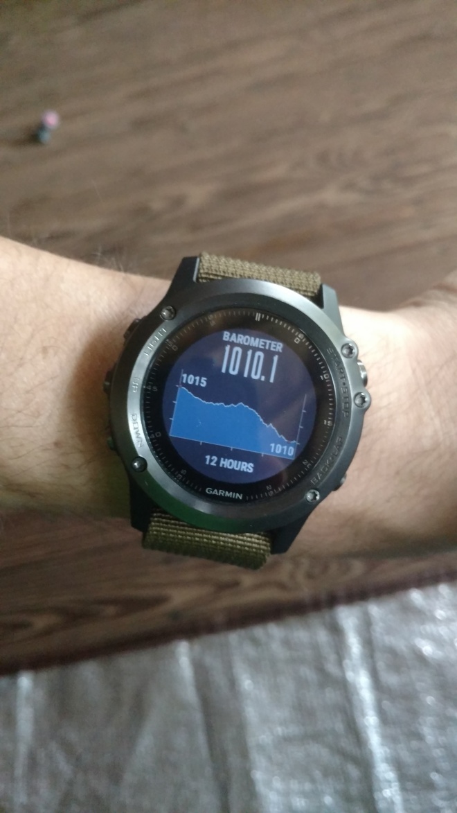
Since revising our itinerary early in our trip our plan for the day had been to hike out to Huginnin Cove for a visit since we wouldn’t be able to camp there this trip.  This was a good plan since we needed the rest.  We may have cracked our eyes open at around 7, but didn’t actually crawl out of the sleeping bag until nearly 8.  To go with our morning coffee we had Mountain House Biscuits and Gravy, and that turned out to be surprisingly delicious.  I made a second pot of coffee and filled up my thermos so we could bring it along for our hike and enjoy it with a light lunch at the cove.  Just as we were getting our gear ready to head out the barometric alarm on my watch went off, but it was still sunny out.  A few minutes later the low rumbling started, but we didn’t see a cloud in the sky.  Being so close to the ranger station we decided to check on what was going on, Laura had to fill out her wolf siting report anyhow.  Ranger Val greeted us, gave Laura a report to fill out, and pulled up the radar for us.  It wasn’t looking good.  The storm we were observing looked like it would just skirt the north side of the island, but there was another storm to the south and west, near home, that looked like it could be trouble.  We decided to wait out the first storm just to be safe and then we would hit the trail.

IsRo 2016-06-10 (36).jpg
Barometer just after my alarm went off.

And just after 12:00 we made a bee-line for Huginnin Cove.  We hit the first and second intersections pretty quickly, those sections of trail go really quick without all your gear on your back.  Then we crossed the familiar bridge at Washington Creek and from there we slowly started making our way up the Minong Ridge, and before we knew it we were at the split for Huginnin Cove.  Today was a lot like our first trip to the Wild Isle, cool (low to mid 50’s) near the shore, warm (mid 70’s) inter-island.  We passed a lot of familiar places; a little rocky spot above a marsh we stopped for lunch our first trip, a boardwalk along a beaver dam (currently being repaired because it looks like there were some moose vandals) and then the rocky descent to the cliffs of the island’s north shore.  We could tell that we were getting close, the air was noticably cooler, and the fresh breeze smelled amazing. Before we knew it we had dropped down to the lake sure, or cliff-side as it were.

The next mile and a half as every bit as dramatic as we remembered; crashing waves, rocky outcroppings to navigate around, over, and through, and incredible views of the lake beyond.  A little further along we saw the massive boulders that mark the entrance to Huginnin Cove, we were there.  It was every bit as gorgeous as we recalled.  We found a little spot to sit and enjoy our coffee and granola, but that didn’t last long.  In the 15 minutes we were there the Canadian shore went from foggy but visible to to dark and non-existent, that second storm was rolling in and fast.  We quickly packed up our belongings, snapped a few more pictures, and got moving back towards Windigo. (Click Here for some Photo Sphere’s of Huginnin Cove)


Our anxiety kicked in at first and we were moving at sub 15 minute miles, so I chimed in and Laura agreed that we should slow down, it wasn’t worth someone getting hurt.  On and on we went, through more familiar places, up ridges, through swamps, over boardwalks.  And then it came, but just a few sprinkles at first, so we stopped to pack up the camera and throw on our rain jackets quick.  And on we went, up and down, over, around and through the ravines, swales and ridges of the island.  Then the thunder and lightning came, and the rain followed soon after coming down in buckets.  We were close though.  We hit the west trail intersection and then crossed the bridge at Washington Creek.  So close, but the rain wasn’t showing any signs of letting up and we still had a mile or so to the shelter.  We hit the Windigo intersection and the trail finally widened out to the width of the park’s tractor.  We were soaked, but we made it back and it felt good to be in a dry shelter instead of dealing with the tent.  Luckily our pack towels were dry because we really needed them.  We threw on our dry wool and crawled into the sleeping bag to warm up.  I ended up dozing off for half an hour or so, but then it was time for dinner.  I had been stringing Laura along with this Chili for a few days now and it went great with our last summer sausage and tortillas.

IsRo 2016-06-10 (132).JPG
Still laughing despite the impending rain!
IsRo 2016-06-10 (134).jpg
Still smiling despite the rain!


After dinner the skies were still cloudy and we were beat so Laura turned in and I spoke with some other campers who wandered by our site for a bit.  It was nice to hear stories from another experienced visitor, and I’ll definitely be taking some of his advice in the future.


Day 6 – Big Push – Thursday June 9, 2016

IsRo 2016-06-09 (12).jpg

IsRo 2016-06-09 (16).jpg

The eerie call of a loon woke me up long before my alarm went off, so I just laid there and listened for a while.  At 4:30 my alarm finally went off and since it was already fairly light out we got right to work packing up camp.  Cold granola with milk and blueberries was on order for the day, and the coffee I made the night before was still pretty hot.  Packing went quick since we did most of the work the night before, so we were on the trail by 7:00 A.M.  The trail out of camp to the intersection was even drier than the previous days hike, and then we turned West to head up the Greenstone.  And up we went!  The first push up the ridge was a bit of a bear, but the view of Lake Desor  from there was pretty incredible.

IsRo 2016-06-09 (18).jpg
Looking over Lake Desor

IsRo 2016-06-09 (20).jpg

We couldn’t hang out though because we had a long way to go, so up and up we went some more.  In fact, we passed Mount Desor so quickly  we didn’t even realize it.  Being awake and leaving so early we figured we would at least see some wildlife, hopefully some moose with all the signs we’d seen the previous day, but all we saw was a lot of fresh prints.  The first 3 hours went by really fast, and before we knew it we were at the Island Mine intersection.

IsRo 2016-06-09 (21).jpg
One of the longer boardwalks we had to cross that day.  Don’t step off the side, you may loose a boot!

We had started a Casche Lake Wild Rice Salad the night before so it would be ready to go whenever we took a break, and sure enough it was.  After eating we pushed on, up and over Mount Sugar, then back down, and up, you get the idea if you’ve been following along, more down, more up… Around the 8 mile mark we stopped for a little snack and to adjust our packs at a little stream crossing.  With both of us being tired, and the footing for the crossing being slightly sketchy, I helped Laura across and then went back for my gear.  Then we had another little ascent and finally things started heading down hill.  At this point we passed two groups that must have gotten off the boat today, they still smelled fresh and looked happy to be on the trail.  We continued along, slowly but steadily descending until we came to another little stream crossing, but then the trail started to climb?  This left me a little confused, I was pretty sure we were further along.  Time to pull out the map.  I oriented myself north and looked down at the map, oriented it accordingly and looked close at the map.  We still had one steady but not too steep of a climb, then the earth would seem to drop out from under our feet.  After another 15 minutes or so the trail got noticeably steeper.  When mountain biking, as soon as you point downhill you let off the brakes and hold on, and it feels good.  That just isn’t the case with backpacking… you’re trying to ride your brakes, carefully choosing your line, and every misplaced step hurts, sometimes a lot.  And if you stumble with a 40lb pack on your back the consequences could be a lot more serious so you better be sure of your footing.  The next mile or so we lost over 200′ of elevation and it was probably the most painful mile of the trip so far.  We were already 11 miles in at that point, so we felt every footfall, and every step seemed to be rocky and off camber.  But we made it down and it was pretty flat at the bottom, and sometimes really rooty.  It felt good because we knew we were getting close to our destination.  Before we knew it we were at the intersection for the Greenstone Ridge and Minong Ridge trails.  “We’re here” Laura chimed.  “Not Quite” I replied, and I got a quick snarky “Liar, you lied to me” back as a response followed by a big gasp, being jokingly accused that I had been stringing her along with promises of goodies at the store and making her think we were closer to the Washington Creek campground.  We only had another 0.3 mile to go to the group campground and a touch further for the solo sites.  Once we got there several shelters were open at the far end of the site, so we grabbed #14 and dropped our gear on the picnic table, ripped off our boots, and collapsed on the bench with some dried fruits.  It felt good to be done for the day as it was a little bigger feat than we had previously thought it would be.  That made me even more glad we didn’t follow our previously chosen route down the Minong Ridge.

IsRo 2016-06-09 (22).JPG
It was nice to NOT have rain at the Windigo dock for a change.

After about an hour we ran, er, stumbled down to the store to scope out what they had for goodies.  After looking around for a bit we decided on a Hershey bar, a Mounds bar, and Nutter Butters.  We wandered over to the visitor center to check out the daily weather posting where we were greeted by Ranger Val and informed her that Laura had seen a wolf the first day and she asked us to stop by to fill out a report the next morning.  Next it was time to figure out dinner, which was a bigger challenge than one might expect.  We just couldn’t settle on any one thing, but finally chose the last Cache Lake Chicken Stew, summer sausage, and tortillas.  That really hit the spot after our long day on the trail.  We quickly got things cleaned up and then set the shelter up for the night, laying out some wet gear that hadn’t dried the previous days.  After our gear was settled we strolled down to the dock and plopped down on a bench near the pavilion that they do the ranger talks at.  There were some divers and fisherman making their dinners and the fresh lake trout the fishermen were frying up smelled amazing!  The sun was starting to go down, so we nibbled on our chocolates and enjoyed the sunset.  I’m not going to lie, after 6 days on the island eating freeze dried and dehydrated foods the chocolates were REALLY good.

IsRo 2016-06-09 (25).JPG
A pink lady’s slipper I spotted near our shelter.

IsRo 2016-06-09 (27).jpg

IsRo 2016-06-09 (28).jpg
C’mon dinner!  Washington Creek in the background.
IsRo 2016-06-09 (47).JPG
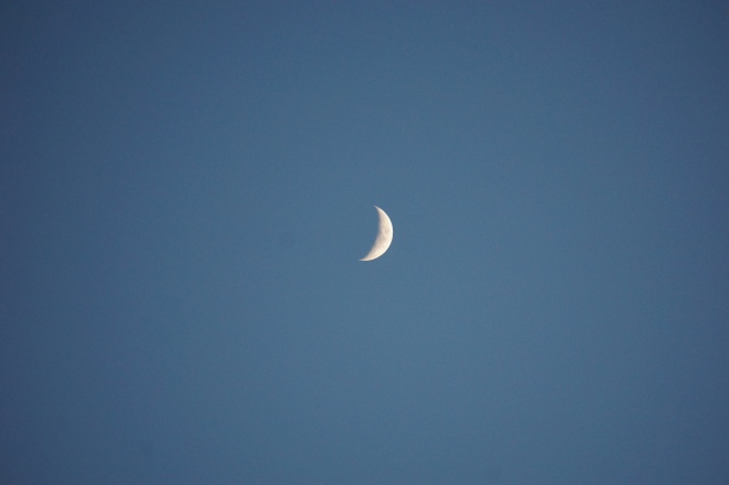
The Moon was finally showing itself.
IsRo 2016-06-09 (36).jpg
Sunset at Windigo

After some time at the dock we moseyed back toward the shelter, stopping to watch a few loons (there were over 100 nesting pairs on the island this year) along the way.  The air had cooled pretty significantly at this point, and after a long day it was finally time to get in our cozy wool clothes and drift off to the sounds of the island.

IsRo 2016-06-09 (66).jpg
Sometimes it was hard to know when you were being watched… 


Day 5 – Day of Rest at Lake Desor – Wednesday June 8, 2016

IsRo 2016-06-08 (8)
A beautiful clear morning
IsRo 2016-06-08 (4)
Morning visitors to our “bench”


Even though I set an alarm for 4:30 to watch the sunrise, I wasn’t ready to get up, so I didn’t.  This was our day off, a rest day, and it was only 40°F out.  Sounds like a few good reasons to sleep in and snuggle with my honey.  We finally rolled out of the tent at 7:30 and got water going for coffee and breakfast.  While enjoying our coffee we discussed our plans for the remaining days we had on the island.

IsRo 2016-06-08 (12)
Duly Noted.  I think this applies to red squirrels too.

After sorting out some things with our gear and getting some stuff pulled together for lunch we pulled on our boots that were FINALLY dry.  We hit the trail at 11:30, the sun was shining, blue skies, and just a few clouds to make for a picture perfect day.  The hike up to the overlook of Lake Desor that we had passed the day before wasn’t very long, but it was just what we needed to keep our legs moving.  It was definitely worth the return trip as the views of the lake and beyond were amazing and it felt great to sit on the sun baked exposed rock.  While there we had a light lunch, a few laughs, took some pictures, and chatted with some other travelers about their adventure.  After a little over an hour we turned back towards camp.  The return was just as uneventful as the hike out, which was nice, and the trail was even more dry than the previous day.  The blue skies were helping to improve our moods too, lets hope that continues for tomorrows big push.

IsRo 2016-06-08 (14)
How many of these little guys would it take to make dinner?

This slideshow requires JavaScript.

IsRo 2016-06-08 (31)IsRo 2016-06-08 (43)IsRo 2016-06-08 (27)

IsRo 2016-06-08 (38)
Empty thought bubble?  Full island immersion accomplished.

Once we got back to our site we kicked off our boots and relaxed in the tent for a while, away from the bugs and out of the sun.  After another hour or so I decided to explore more of the campground while Laura rested since I could see the trails stretched a little ways before getting to the group sites.  It was clear that at least two moose, a cow and a calf based on the prints, had been through before yesterdays rain, but it didn’t appear that they came back through.  The group campsites looked pretty nice here and they had slightly better access to the lake and a nice beach to watch the sunset from.  Sunrise would be a different issue though as it would be to your back from the beach.

IsRo 2016-06-08 (58)-COLLAGE


I eventually made it back to camp and we started getting things ready for the next day, reorganizing our packs and making sure everything we needed for the next day was easy to get to so we could get an early start and hit the trail.  While I was taking down our filter bag Laura went back to my pack to grab our folding bucket, and as I was unclipping things she called me over with a calm tone but with some definite urgency in her voice.  I set things down thinking maybe she saw a wolf, or worse, a mama moose with calves.  Not one to miss a good opportunity for some unique photos I picked up the camera and went to see what was going on… It was probably the largest Wolf Spider I had ever seen at about 5″ across, and it was hanging out on the back pad of my pack.  The previous day we had leaned our packs against some birch logs that were stacked as a bench we had been sitting on and they must have been living in the gaps between them.  The cooler weather was keeping all the critters moving slow, so I grabbed a stick and got rid of it.  We had seen large spiders in the wild before, but nothing like this guy.  After hustling back up the hill from getting water at the lake we started things for dinner and got things for coffee for the next day.  After we moved our gear away from the spiders I went to start the stove and noticed that there were bees coming and going from a hole under the rock Laura had used as a bench while cutting up the summer sausage on a flat rock table the previous night… looked like we had a hive right under our feet!  Luckily it had been cold and it looked like they were just trying to absorb what heat they could from the sun baked ground.  All in all, this meant that we had been dealing with ants near our tent, spiders under/around the logs we were using as a bench, and bees under our cooking area, not to mention the mosquitoes and gnats.  Oh, and we can’t forget the watchful little red squirrel that had clearly become adept at stealing food.  But nobody had gotten hurt or stung, just mosquito and gnat bites, so that was good.

IsRo 2016-06-08 (106)
Our new friend, but we weren’t too interested in hanging out with him.
IsRo 2016-06-08 (108)
Laura was especially grossed out by our new friend.

Finally time for dinner… I moved our gear once again and finally got the water going.  Noodles with chicken, roasted veggies, and raspberry crumble were the order of the day, and it turned out to be one of the more satisfying meals we had after adding a little garlic salt and black pepper to liven things up a bit.  I finished making coffee for the next day, poured it in my trusty Stanley thermos, and we cleaned up our dishes from the night.  Then it was time to pack things up and make sure our gear was ready for the next day, while also making sure we weren’t providing a home for any spiders.  With the clear day and some light clouds in the sky it was finally time to head down to the lake to enjoy the sunset.  While it wasn’t the most spectacular we had seen on IsRo, we were joined by a pair of loons who I suspect had a nest nearby because I kept seeing them fly in that direction through the afternoon while I was exploring.  If you know Laura at all, you know that the site of these loons had her glowing, they are probably her most favorite bird.  I had tried getting pictures of them earlier in the day, but they would never stick around.  Of course they would stay while Laura was around though.

PANO_20160608_180648.jpg
Our packs started to the left of the log bench, but there were lots of big spiders so we moved them, then we tried cooking on the rocks between our packs and where the stove now sits, but there were bees, so we moved to where the stove is now.  To top things off there were ants between where the stove sits and the tent.  So many critters!
IsRo 2016-06-08 (109)
Morning coffee made the night before thanks to a little help from Stanley and GSI.

This was probably the latest we’d stayed outside of the tent for the whole trip, and we needed to get some sleep.  Tomorrow was going to start early and it would be a long day on the trail.


Day 4 – A Tale of Two Lakes – Tuesday June 7, 2016

The morning started off like any other, chilly and early. But with a distinct lack of overnight precipitation in the air I was hopeful. What a nice change that was. In fact, the barometer had been slowly climbing through the night and the breeze coming off of Hatchet Lake was definitely drier than it had been. We quickly got water boiled for breakfast (Alpine Aire Granola w/ Raspberries) and coffee then started packing up camp. While it would have been nice to hit the trail a little sooner, a 9:00 a.m. start wasn’t bad with the drastically improved weather we were having. As Laura pulled on her boots I had her slip some Ziploc bags over her feet to help battle the constant dampness she’d been battling in her boots. She thought it was silly at first, but I just asked her to trust me about this.

IsRo_2016-06-07_ (2).jpg
Leaving Hatchet Lake.

And then up to the Greenstone Ridge we went…. And up…. and up… and up some more. It was almost as if we were chasing the giant up the bean-stock. We eventually crested the ridge and were blessed with a view of Siskwit Lake and Lake Superior we had been waiting for all trip. At some point during our climb the clouds had parted and made room for the sun and blue skies.

IsRo_2016-06-07_ (4)
Lots of moose tracks but no moose…

IsRo_2016-06-07_ (7).jpg IsRo_2016-06-07_ (10).jpg

After a quick adjustment to our packs we turned west toward Lake Desor. While the first few rocky ascents on the ridge were tough, it was clear that today would be much easier than the hike to Todd Harbor on Sunday. The climbs and descents were more sustained than the punchy ups and downs of the Minong Ridge. I kind of laughed because it reminded me of riding a single speed mountain bike, using your momentum to get you up over the rocks, logs, and little climbs, keep a steady pace through the flat parts, and then pointing downhill and enjoying the descents. Only with backpacking you have to manage your speed on the way down more because it’s hard on the knees and you’re more likely to get hurt badly if you fall.

IsRo_2016-06-07_ (20).jpg IsRo_2016-06-07_ (21).jpg

About 2 1/2 hours in we made it to Ishpeming Point where there is an old observation tower. You can’t go in because it’s locked up, but there’s a nice flat spot underneath to take a break and get out of the sun. As we were enjoying a snack two fathers and their two sons came up the trail. After some chatting I discovered they had been to Philmont twice in the last few years and that their thoughts on the increased difficulty of the terrain on IsRo echoed mine. Before we were back on the trail I had to make a quick repair to my boot lace. At some point the sheath of my lace had worn through leaving the core exposed, so I cut it apart and used a square knot to join the two pieces together again. About that time Blake and Carl showed up, we chatted a bit, I had a few handfulls of granola we had brought along with, and we were back on our way.


From Ishpeming Point to Lake Desor things were a lot more wet and swampy, but we pushed through. We had a few more ascents, and at the trough of every little ridge there was always a swampy bit to navigate, some of them quite long. After we hit the top of the last ascent we hit a rocky clearing and got a great view of Lake Desor. A bit further down the ridge we made it to the Lake Desor intersection, we were getting close! We turned north and pointed ourselves down the slope towards the campground. It welt like we were loosing elevation for quite a while. The trail here was quite wet from runoff on the ridge the previous days, but it was pretty clear that it had been worse earlier in the day, and much better than the cedar swamp we passed through on Sunday. We eventually made it to the campground and selected site #3 as our home for the next two nights. We decided on 2 nights because the next campground, Island Mine, had been pretty busy from reports by other hikers and lacks the privacy we had become accustomed to. So we were going to spend an extra night at the South Lake Desor campground to rest and push all the way to Windigo/Washington Creek on Thursday. Boy did it feel good to get the boots off though, and as I predicted Laura’s feet stayed dry!

IsRo_2016-06-07_ (35)

We finally got our camp set up and started getting some stuff ready for dinner when out of nowhere it started raining again! We quickly made our way to the tent and enjoyed some of the dried fruits we brought along to hold us over until the rain let up. After about an hour we emerged from the tent to fetch water and get things going for dinner. Once we crawled out it was pretty clear it had cooled off because when we were setting up it was 64°F out, but after the rain it had dropped to 49°F. Laura took to the task of cutting up a summer sausage we had brought with and I got the stove ready to boil water. After 10 minutes the water was boiling and ready to add to our meal, so I lifted the lid to check it and noticed a yellow and green thing swirling around in the water…. somehow a slug had gotten under the lid and made it into the pot! Yuck! Time to start over. After another 10 minutes to get the stove going and water boiling again we were finally ready to eat. We knew we liked the Mountain House Pasta Primavera from our other trips, but it was pretty much decided that tortillas and summer sausage are about the best thing to bring on a trip like this.

IsRo_2016-06-07_ (47).JPG IsRo_2016-06-07_ (41).JPG  IsRo_2016-06-07_ (80).JPG

As we finished up dinner it looked like we were finally going to get a good sunset. We hurried to get dishes cleaned up, readied a few things for the tent, and then went down to the lake to enjoy the sunset. While it hasn’t been my favorite, that is reserved for Huginnin Cove, it was quite beautiful and it seemed to go on forever. Once it started to get dark it was finally time to settle in for the night and listen to the cry of the loons.

IsRo_2016-06-07_ (63).JPG

IsRo_2016-06-07_ (78).JPG

IsRo_2016-06-07_ (89).JPG